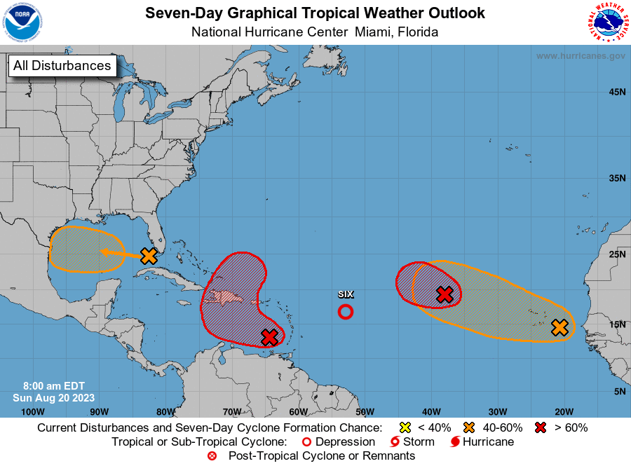
SAN JUAN — The National Hurricane Center has increased the formation chance to high in the next
couple of days for Invest 90L, currently located over the eastern Caribbean.
Regardless of development, unsettled weather conditions are expected to occur between today and early Wednesday.
The resulting rains from the expected enhanced showers and isolated to scattered thunderstorms could result in flooding impacts and mudslides in areas of steep terrain. Breezy conditions and thunderstorm activity may also result in deteriorating marine and surf zone conditions.
Potential Risks and Impacts
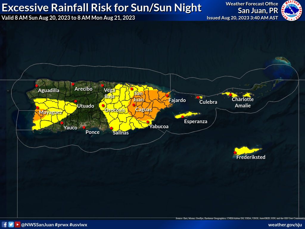
● Excessive Rain: Rainfall amounts between 1-4 inches (Fig 2) are expected, with localized
higher amounts.
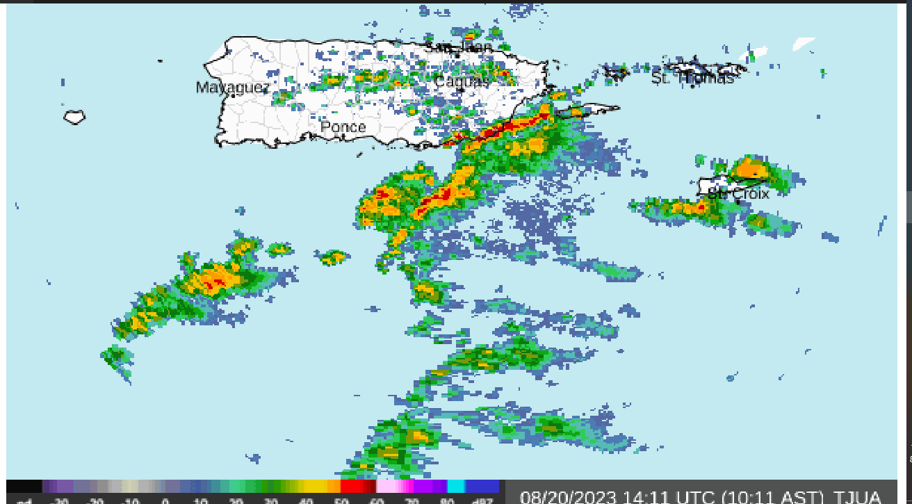
○ Where and When: Most of the forecast area will receive some rains, however, highest amounts are anticipated in the southwestern, southern, southeastern, and eastern Puerto Rico. The leading edge of Invest 90L is already affecting the Caribbean waters with shower and thunderstorm activity reaching St. Croix and Vieques during the morning hours. Weather conditions are expected to gradually deteriorate throughout the day, mostly for Culebra and the eastern half of Puerto Rico, increasing in coverage and intensity tonight. This will continue into Wednesday, potentially with lingering we unsettled weather conditions for the rest of the workweek.
○ Impacts: Expect ponding of water in roads and poorly drained areas to flooding of urban
areas, roads, and small streams. Life-threatening flash flooding and mudslides are likely,
particularly across south, southeast and east Puerto Rico.
● Marine: Expect building seas of up to 8 feet with occasional higher seas, and winds between 20
to 25 knots with gusts up to 35 knots or higher. The highest seas and strongest winds are likely
across the offshore Caribbean waters and local passages. Small Craft Advisories are in effect
for these areas, while small crafts should exercise caution elsewhere.
Other Weather-Risk Hazards
○ Thunderstorms: Isolated to scattered thunderstorms will produce frequent lightning and
thunderstorm winds in some areas. Be aware of thunderstorms in your area and be prepared to stop all outdoor activities and take shelter.
○ Wind: Breezy conditions, with maximum sustained winds of 15-25 mph and gusts up to
35 mph. The strongest winds are likely across coastal areas of southern Puerto Rico and
the U.S. Virgin Islands. Unsecured items could blow around.

○ Rip Currents: Moderate risk of rip currents, with breaking waves of at least 6 feet. The
highest breaking waves are likely across beaches of southern Puerto Rico, Vieques,
Culebra, and Saint Croix, where life-threatening rip currents are possible.