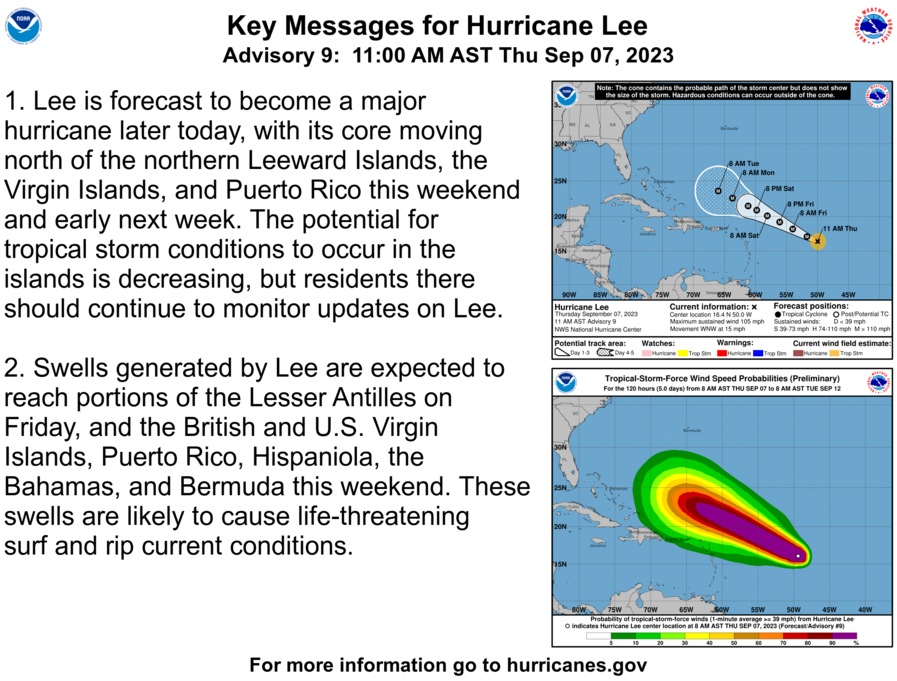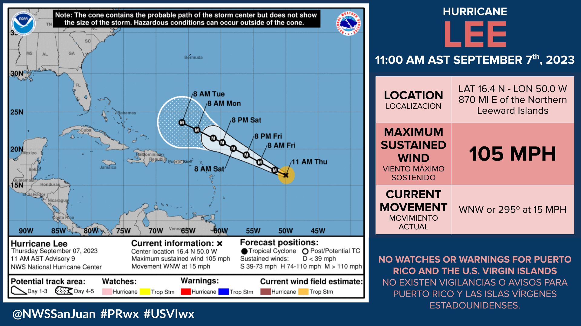
SAN JUAN — Hurricane Lee was located at latitude 16.4 N and longitude 50.0 W, at 11:00 a.m. today is expected to continue moving west-northwest at 15 mph.
In the latest update by the National Hurricane Center, Lee is forecast to rapidly intensify and develop into a major hurricane in a day or two, passing a couple hundred miles north of the islands between late Sunday and Monday.
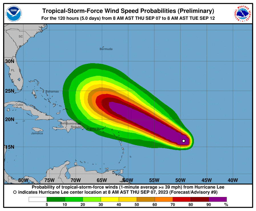
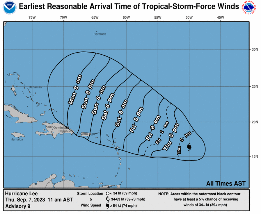
Potential Threats: Hazardous marine and coastal conditions are expected as early as Saturday and should last through next week.
Swells from Lee will build seas between 8 and 12 feet during the weekend across the Atlantic and eastern waters of the islands.
Higher seas are possible due to the expected intensification of Lee as it moves closer to the
northeastern Caribbean.
These swells will also cause large breaking waves along the north and east-facing beaches of Puerto Rico and the U.S. Virgin Islands, which in turn will cause high surf and life-threatening rip currents.
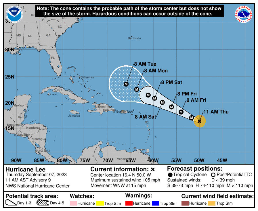
There is still too much uncertainty regarding rainfall and possible wind impacts, as Lee is forecast to pass a couple hundred miles north of the islands.
Lee slowed down from 14 mph to 13 mph overnight and it is forecast to rapidly strengthen.
Forecast track maintains Lee well to the northeast of Puerto Rico and the U.S. Virgin Islands.
The next tropical update from National Weather Service in San Juan is scheduled for 6:00 p.m. today or sooner if conditions warrant.
https://www.disasterassistance.gov/aggregator/sources/11